Nuraghe in Sardinia
There are said to be over 7,000 nuraghe in Sardinia, in various states of ruin. These are the conical dry-stone towers, unique to Sardinia. Many have surely been destroyed, and the original number is thought to be around 10,000. They range in design from single, isolated towers to more complex structures with a number of towers surrounded by the remains of a settlement. Unfortunately, very few of these have been fully excavated. One that has been extensively excavated and restored is Nuraghe Su Barumini. In 1997 it was listed as a UNESCO World Heritage site, the only such site in Sardinia. There are, however, many, many more that are well worth visiting.
Suggestions for the Most Representative Nuraghe to Visit
Nuraghe Arrubiu, Orroli
Taking its name from the reddish lichen that covers the rocks that make up the ruins, Nuraghe Arrubiu is thought to be the largest surviving nuraghe in Sardinia. The central tower is estimated to have been between 25 and 30 m in height. In all there were 21 towers, and the complex covered an area of about 3,000 square metres. It was built towards the end of the 14th century BC, when the island had considerable contacts with eastern Mediterranean lands, particularly Cyprus and Mycenae. The settlement was abandoned and collapsed around the 9th century BC.


Nuraghe Coa'e Serra
South of the Golgo plateau, which formed some 2.5 million years ago from a basalt flow, is what appears to be little more than a pile of rocks obscured by vegetation. The Nuraghe suffered many collapses in the past. It is a complex example, perhaps three-lobed, that was built in several periods using local basalt. In the immediate are traces of a village, although the entire plateau has numerous remnants of Nuraghi, and other historical sites. To visit the plateau, take the scenic route from Baunei.

Nuraghe Corvos
To the visitor’s eye, this structure has a peculiar two-tone appearance, given by the presence at the base of large blocks of freshly hewn limestone, while at the top there are well-crafted blocks of dark trachyte, added at a later date probably to repair a collapse of the upper structures or to add an additional floor. The nuraghe was of the complex type, with two secondary towers around the central one, although these are no longer clearly visible. Given the good condition in which it has been preserved, it is still possible to explore its interior. It is easily found along the provincial road 97 that connects Florinas to Banari.

Nuraghe la Prisgiona
Nuraghe La Prisgiona in the Capichera valley, is located near the town of Arzachena and the popular tourist coastal area of Costa Smeralda. It comprises a large nuraghe (tower) surrounded by a settlement that once covered an area of 5 hectares. The nuraghe consists of a central keep and two side towers. This particular settlement was inhabited between the 14th – 9th centuries BC. And there is also evidence that the settlement may have been occupied during Roman and medieval times. Excavations have revealed over 90 circular stone huts connected connected to each other by paved walkways.


Nuraghe Losa
Just a stone’s throw from State Road 131, Sardinia’s main arterial road, lies one of the most recognisable Nuraghi on the island’s landscape, which stands out due to its organic form. The structure dates back to between the 15th and 12th century B.C., while the area was also continuously frequented in the Roman and early medieval periods. It is of the complex type, with three towers arranged around the central one creating a perfect triangle, protected by an oval wall. Traces of a village surrounded by walls remain in the surrounding area. The site forms the centre of a vast archaeological park, accessible to visitors.

Nuraghe Lugherras
Named from the many Punic-Roman votive oil lamps found, from when the site was used as a temple to Demeter and Kore. This large and relatively well-preserved nuraghe in central Sardinia is a good example of a trilobate type. It was built in three different phases, the first being the central tower built sometime in the 14th – 12th centuries BC. Certain internal structures have survived: the central chamber with a 9 m high tholos roof. Beyond the tower there are traces of a village and a Tomb of Giants. From Paulilatino, take Provincial Road 11 towards Bonarcado and turn right onto a dirt road as soon as you see the signs.

Nuraghe Mont'Arbu
In the heart of the Park of the Seven Brothers, a large green lung in southern Sardinia, stands the nuraghe Mont’Arbu, which is difficult to reach and is mainly visited by hikers and mountain bikers. It is of a complex type, and sits atop a rocky outcrop from which the entire surrounding area can be observed. At some time in the nuraghe’s history it must have been much more structured than it appears today, with several service rooms and annexed enclosures. Today only part of the elevations of the two towers and a small section of the walls are preserved.

Nuraghe Oes
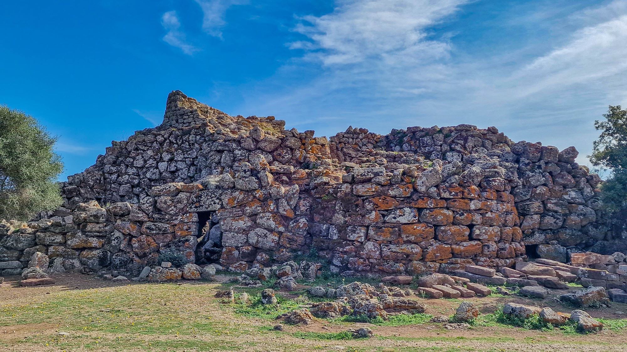
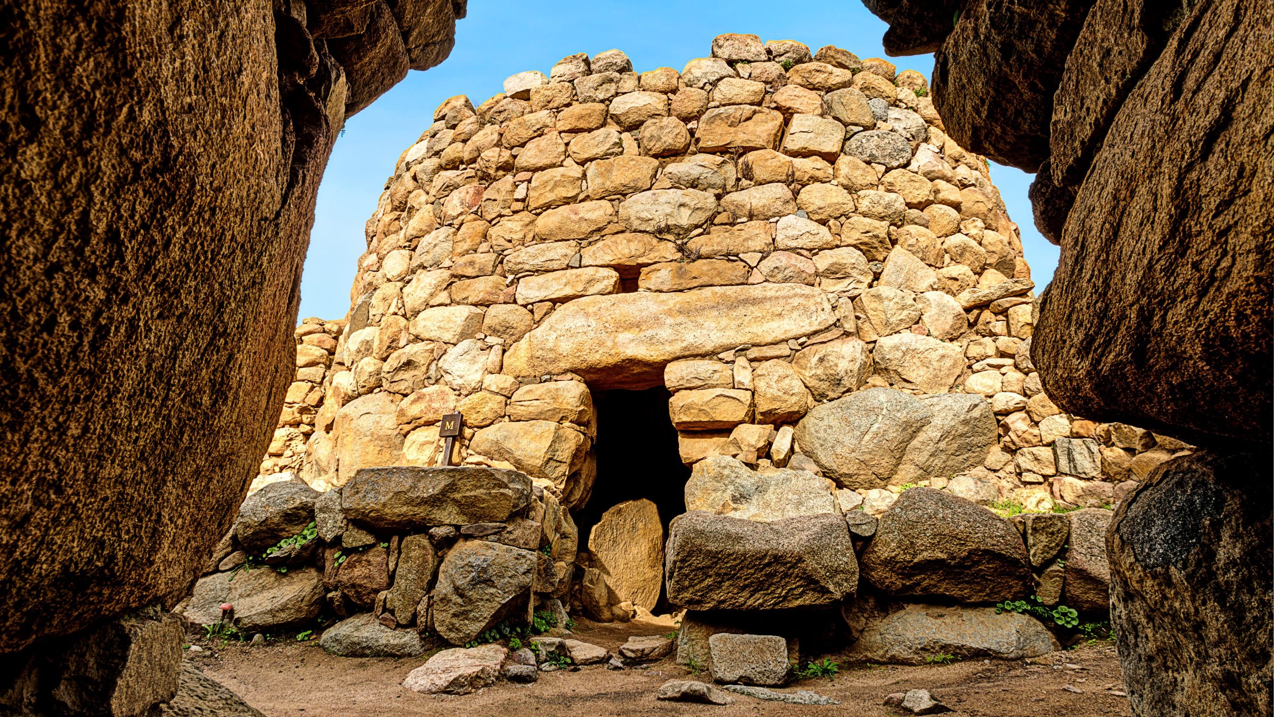
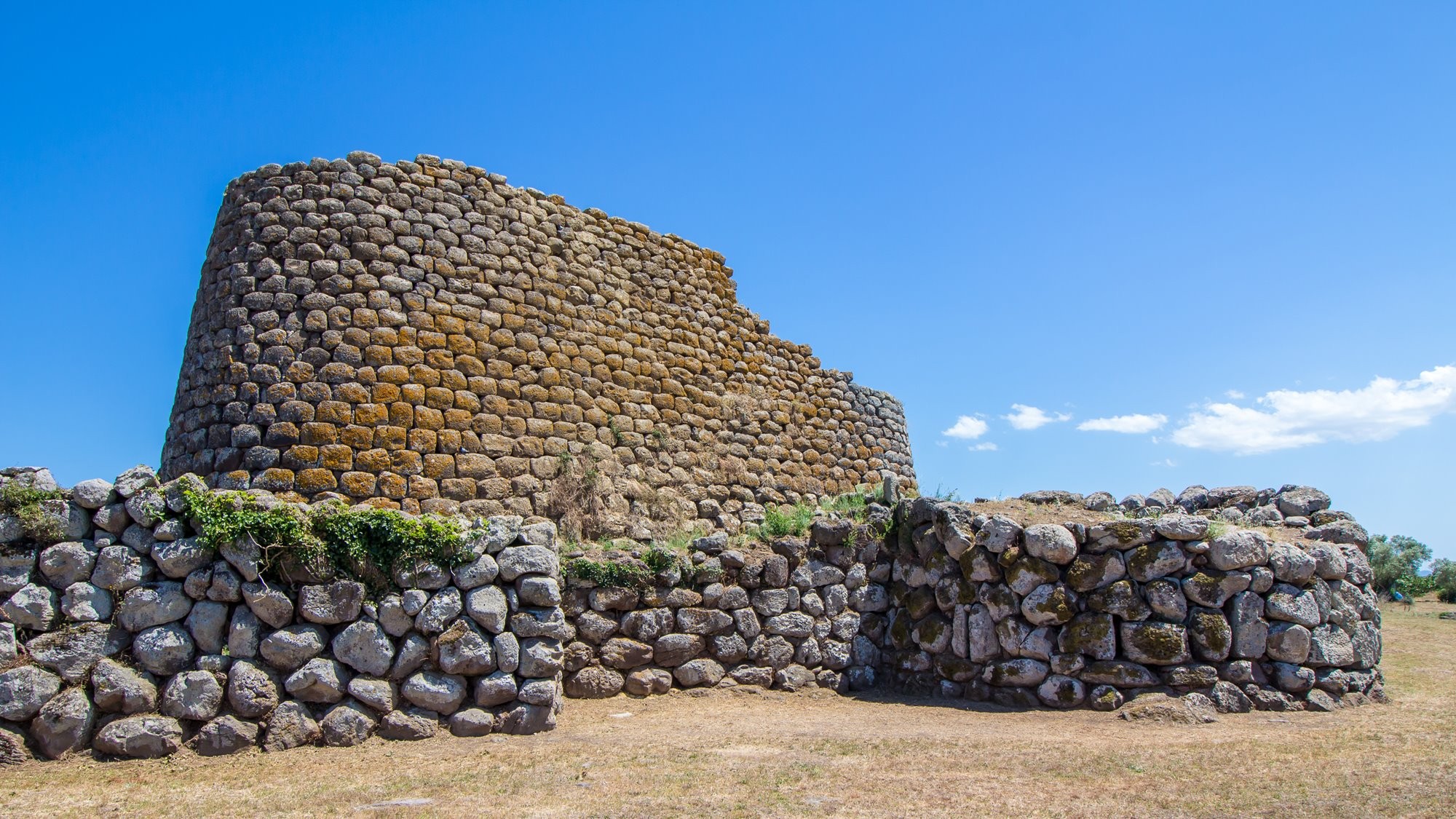
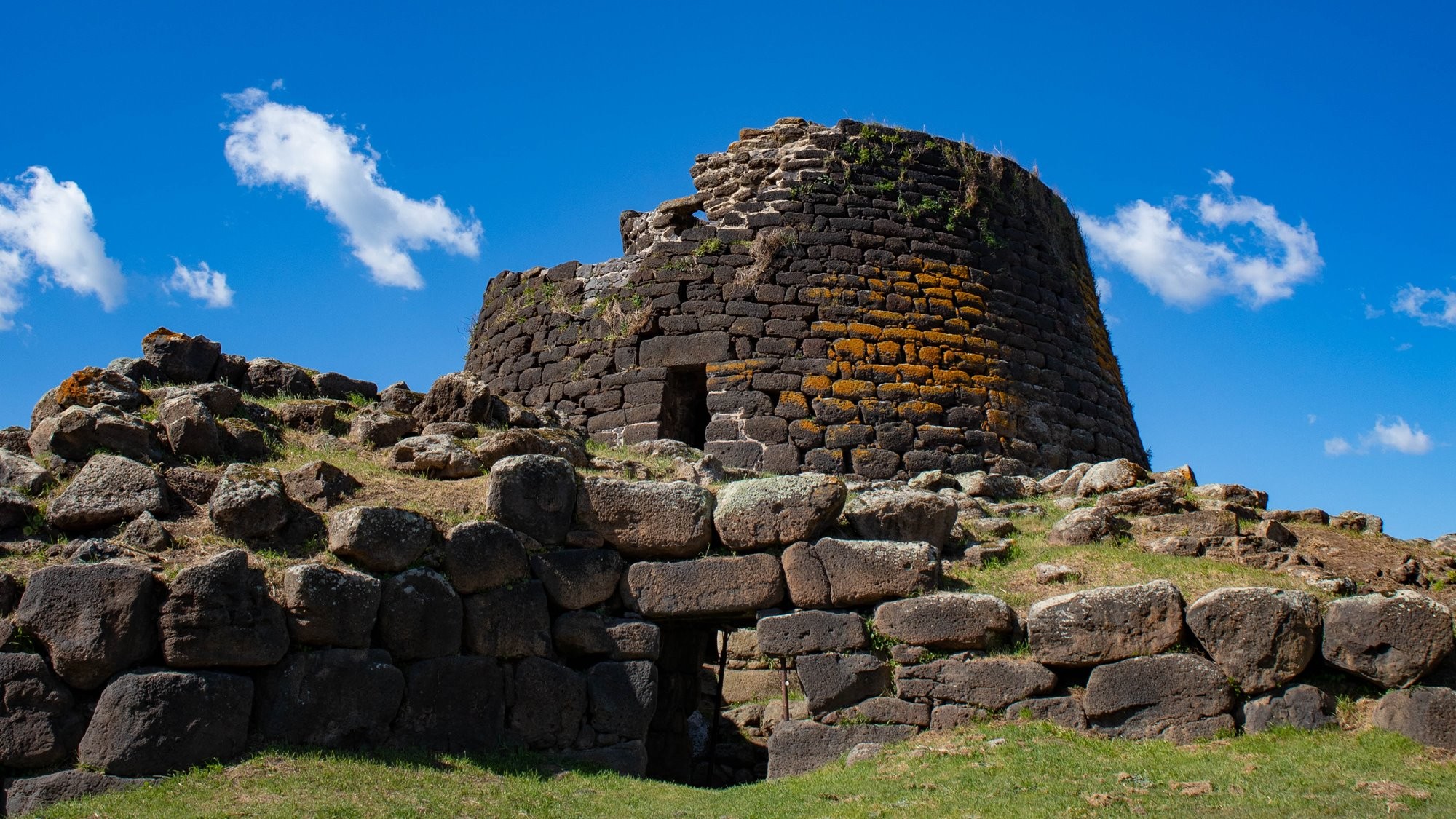
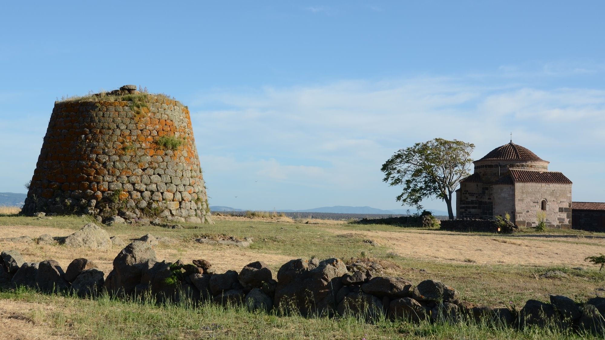
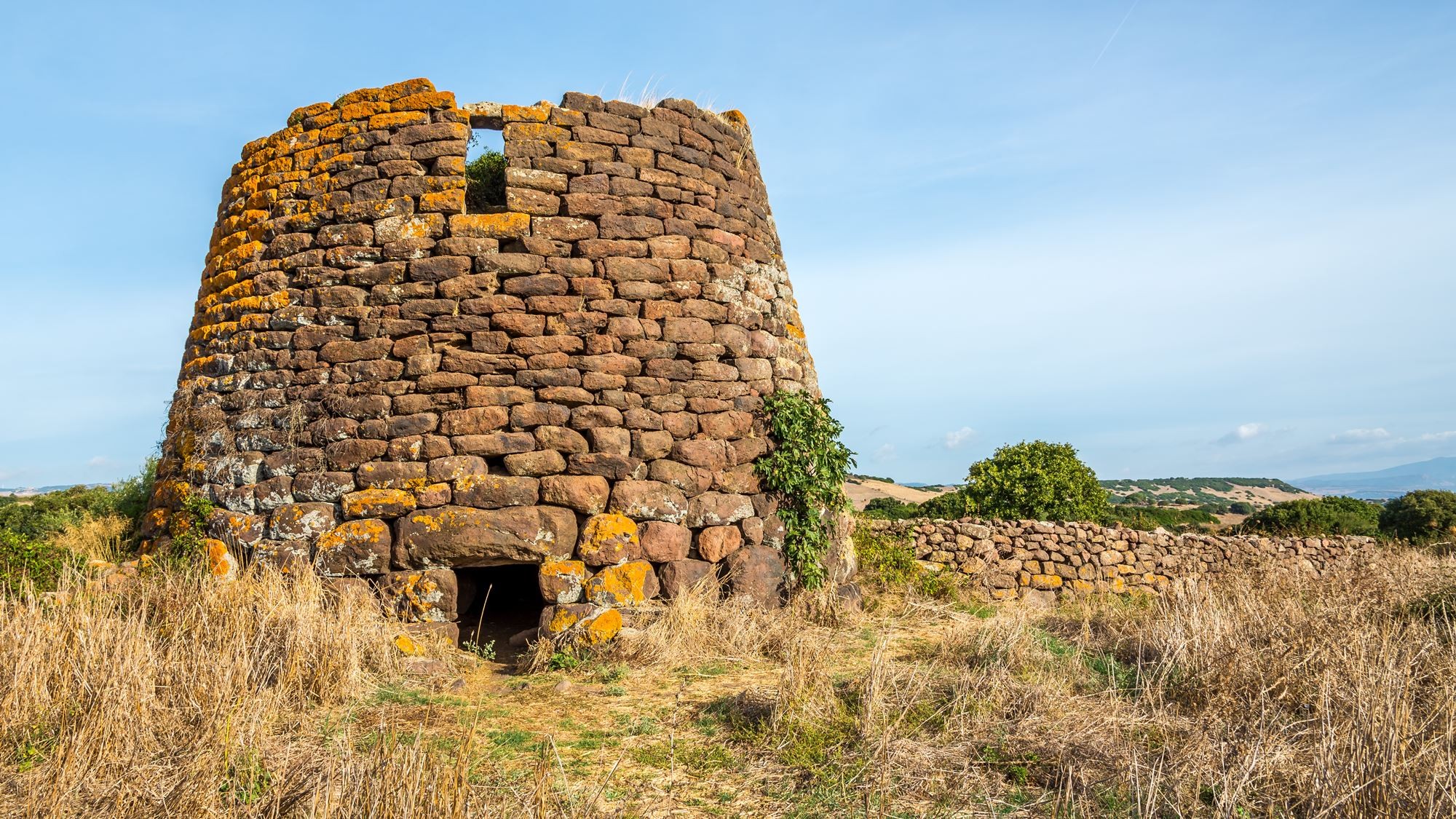
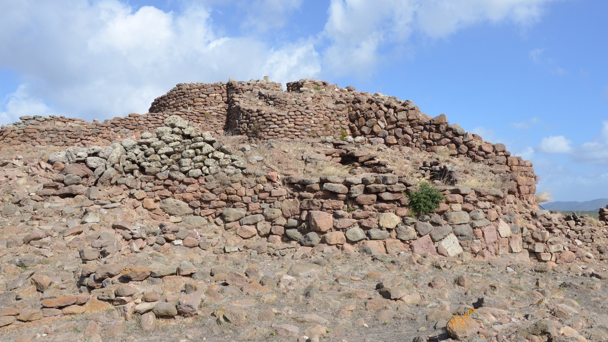
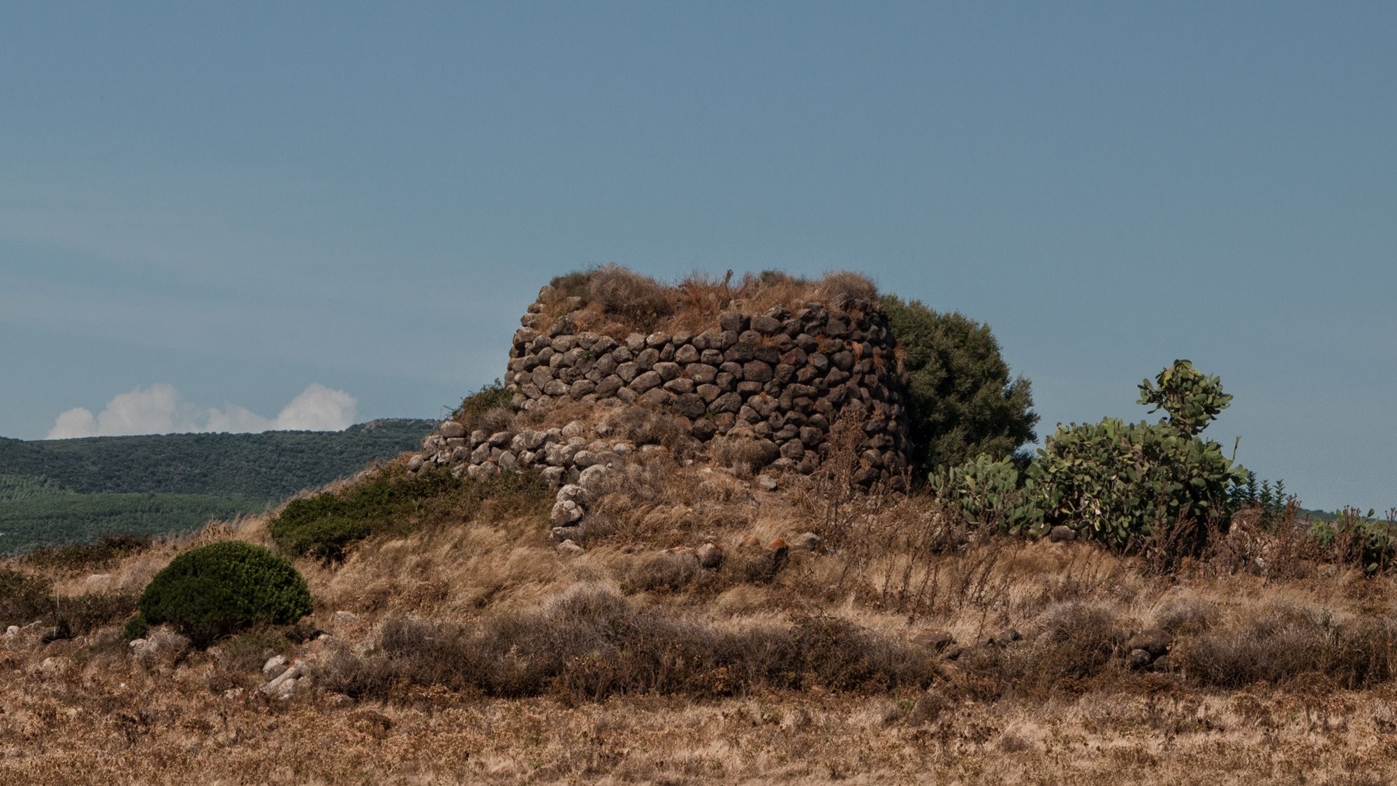
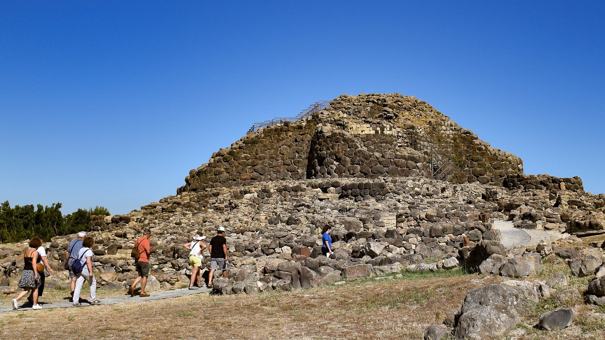
Located in the ‘Valley of the Nuraghi’, so called because of its great concentration in the area. The uniqueness of Nuraghe Oes lies in the unusual architectural feature of the modification of the central tower, once developed on three floors with tholos-roofed chambers, later replaced by wooden floors. The nuraghe is of the complex type, built between the 9th-6th centuries BC, and features extremely elegant shapes and refined, almost polygonal basalt boulders. Around it, traces of other structures remain, such as huts, a Giants’ tomb and a sacred area. It is located next to the railway line, a few hundred metres from Torralba station, and is easy to spot.

Nuraghe of Santa Sabina
In the municipality of Silanus there is an interesting archaeological complex, which includes the Nuraghe of Santa Sabina and an adjacent church, built at the dawn of Christianity. The mighty monolith dates back to sometime between the 14th and 10th centuries B.C., and although the upper part has collapsed, it still retains an elevation of 8.60 m. In the area surrounding it are the remains of a village, the sacred well of Cherchizzu and two tombs of the Giants, which allow the settlement to be attributed a certain importance during the Nuragic period. It is easy to reach due to its proximity to State Road 129, which connects Macomer to Nuoro.

Nuraghe Paddaggiu
Visible from the nearby roads is a single, 9 m nuraghe in a relatively good state of preservation. Inside the two internal chambers, one above the other, are connected by means of a staircase. The tower was part of a larger structure that had two further minor towers flanking it. The base of a hut, about 6 m in diameter, and a large enclosing wall suggest the nuraghe was located within a village complex. From here, there are over 20 nuraghi in view across the valley.

Nuraghe Palmavera
A complex Bronze Age Nuraghic site situated in the territory of Alghero. It comprises a central tower and a secondary tower, which are joined to an elliptical rampart. Other structures include a pentagonal shaped defence wall with four towers. The nuraghe is surrounded by the remains of a settlement made up of about 50 circular and rectangular huts. Although it is thought that there were 100-150 huts originally. Archaeological excavation has revealed the site was built in three phases between the 15th-9th centuries BC. Numerous information panels set out the site’s complex history.

Nuraghe Piscu
On a hill that dominates the Trexenta territory stands this four-lobed nuraghe, one of the most monumental and best-preserved in the area, surrounded by an outer wall with five towers that housed the village. The very large central tower has a finished and well-kept tholos roof, while the plan is rather strange, as two of the four secondary towers are very close together, almost giving the structure a triangular shape. It is dated between the Middle Bronze and Later Bronze Ages and can be reached via the Central Sardinian state road 128. As the site is not managed by anyone, it can always be visited.

Nuraghe Riu Mulinu
In the Olbia area, atop the Cabu Abbas mountain, lies one of the most representative Nuragic monuments in north-eastern Sardinia. The single-tower Nuraghe was built in a strategic position that gave a view of the entire surrounding area. The tower was surrounded by a mighty wall of about 220 metres, with some points as high as 5 m and as wide. Moreover, given the presence of the nearby spring of Cabu Abbas, it is thought to have been the site of a water cult. The Nuraghe can be visited free of charge every day of the year, but one has to pay attention to the route suggested by the navigator, as the best way to reach it is to pass through via Rughittula and via S’Iscoglia by car, arriving at the spring.

Nuraghe Ruju, Chiaramonti
The nuraghe is the best known in the Chiaramonti area, and also easy to visit as it is located along the road connecting Sassari and Tempio. It is of the single-tower type, dated between 1600 and 1300 B.C., built with large boulders of red trachyte, and has two superimposed inner chambers connected by a narrow staircase. It is in a good state of preservation, but it is currently not possible to visit its interior rooms for safety reasons.

Nuraghe Sa Domu'e s'Orcu
The nuraghe, excavated in 1924 and dated to the Middle Bronze Age, is located in the territory of Sarroch above a small hill in the locality of Sa Punta. It consists of two towers, not of the same age and size, connected by a trapezoidal structure with a very impressive courtyard. The main tower is considered one of the oldest examples of a Nuragic tower, due to the crude masonry technique and the strange proportion of the spaces in the central chamber. The area is easily accessible to visitors, who can make use of various paths and rest areas.

Nuraghe Sant'Itroxia
Not much remains of this Middle Bronze Age, single tower nuraghe. Built on the slopes of Mount Tratzalis, from which it there is an expanisve view of the Gulf of Cagliari. In amongst the Mediterranean scrub vegetation are the ruined walls, 2 m high at most. It is possible to see eight steps in what would have been the left wall of the corridor that led to the upper floor. Climbing the Sinnnai Tasonis municipal road from Sinnai, the nuraghe is on the left of the road, almost directly opposite a farmstead on the right.

Nuraghe Santu Antine
Positioned within the Valley of the Nuraghi, it was in its time a landmark of the entire area, as well as being one of the high points of the expression of the Nuragic civilisation. The structure of a complex typology, dated to the 15th century BC, is in the shape of a triangle, with the main tower in the centre, which must have been 25 m high. In the surrounding area, traces of the village, only partly excavated and reused in Roman times, are evident. The visit allows visitors to fully immerse themselves in the ancient Nuragic structure, which is distinguished both inside and outside by the symmetries and design of the spaces, conceived and realised 3500 years ago.

Nuraghe Serbissi
At an altitude of 960 m, this is one of the rare cases of a nuraghe built at high altitude, in a spot that dominates the territory of Ogliastra. From the village of Osini, after driving along a rather uneven stretch of dirt road, and after walking a short ascent, visitors arrive at this suggestive structure, dated between the 17th and 10th centuries B.C. of a complex type, with several towers arranged around the central one. It was built near a karstic cave, perhaps once used as a warehouse. In the area, traces remain of the huts of a village, two tombs of the Giants, and two minor nuraghi.

Nuraghe Seruci
What characterises this nuraghe of a complex type, perhaps pentalobate, is the archaeological evidence associated with it. It is located in south-western Sardinia, in the Iglesiente area, and can be reached from both provincial road 82 and provincial road 108. Construction began in the 14th century B.C. and continued until the 10th century. The village, built on the slopes of the hill on which the nuraghe stands, is one of the largest in Sardinia, and houses several structures that help to understand the complexity and different facets of Nuragic society. The site allows visitors to explore both the accessible areas of the nuraghe and the important area around it.

Nuraghe Tradori
Next to the state road 292 that leads from Riola Sardo to Santa Caterina of Pittinuri, its ruins appear. The nuraghe is of the four-lobed type but is partially buried, with the central tower clearly visible that still retains its false dome roof, and has been undergoing safety works since 2017. The structure and the area around it have never been excavated, but traces of several constructions referable to a further line of fortifications with towers survive, which are not very visible due to the levelling that the area has undergone.

Su Nuraxi di Barumini
Undoubtedly one of the best-known and best-valued sites on the island, and represents the highest expression of the Nuragic civilisation. The nuraghe, consisting of four towers arranged around a central one, together with an extensive village surrounding it, was uncovered in 1950. The entire complex dates between the 16th and the 6th centuries BC. It is only possible to visit the site by taking a guided tour. An expert guide will take you on a tour of the main features of the settlement and through the narrow passages of the nuraghe, and introduce you to the Nuragic civilisation.

Interactive Map of Nuraghi in Sardinia
Add Nuraghi to Your Sardinia Itinerary & Travel Lists
If you are planning a trip to Sardinia and want to see a few Nuraghe or as many as you can, you can use our Itinerary Builder with the list and map above to create your own travel lists and itineraries. To use this feature, you will need to be a member, login or sign up for membership.Â
The list above only includes the best and most easily accessible Nuraghe. For other types of Nuragic era sites, see our Guide to the Nuragic Civilisation. Or, jump straight to our Interactive Map of Nuragic Sites & Museums.
See our Sardinia Travel Guide for more on the art, archaeology and history of Sardinia. To find more sites and museums to add to your itinerary and travel lists, see our Interactive Map of Points of Interest and/or our A – Z list of Sites & Museums.
